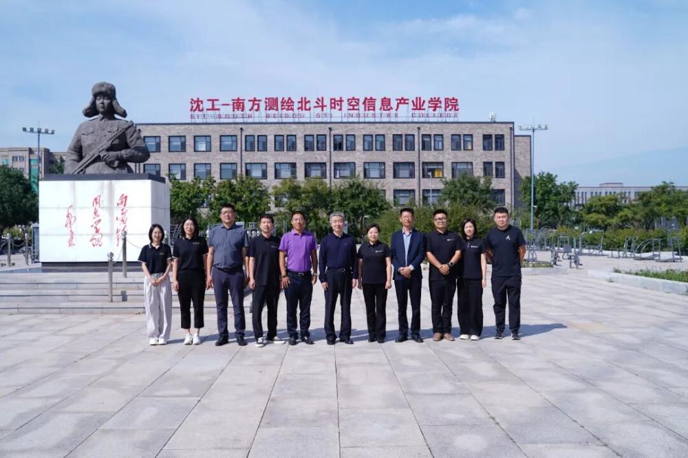
On September 26th, Wu Wenzhong, former Chief Planner of the Ministry of Natural Resources and Executive Vice Chairman of the Chinese Society of Surveying and Mapping, Guo Baoyu, Vice President of Guangzhou Southern Surveying and Mapping Technology Co., Ltd., and Shi Zhongyuan, General Manager of Jiliao Branch, visited our university's Shenyang Institute of Technology Southern Surveying and Mapping Beidou Spatiotemporal Information Industry Academy for inspection and exchange. Hu Xiaomei, Secretary of the Party Committee of our university, and Hao Zhijian, Dean of the School of Energy and Water Resources, accompanied the inspection and conducted in-depth discussions and exchanges on matters related to the construction and development of the college.
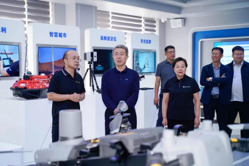
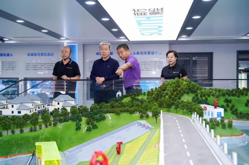
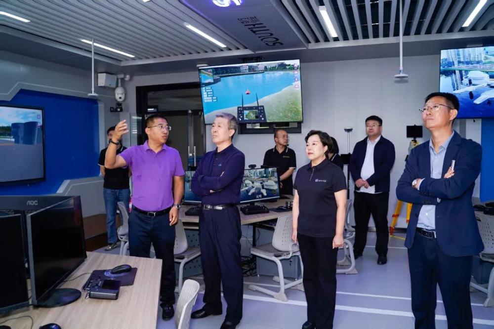
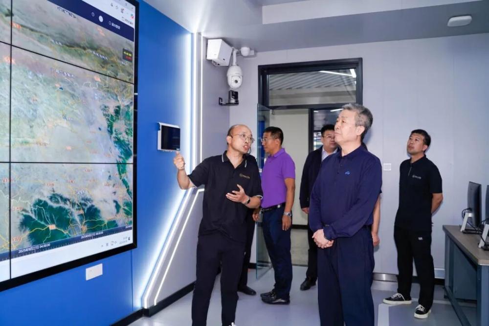
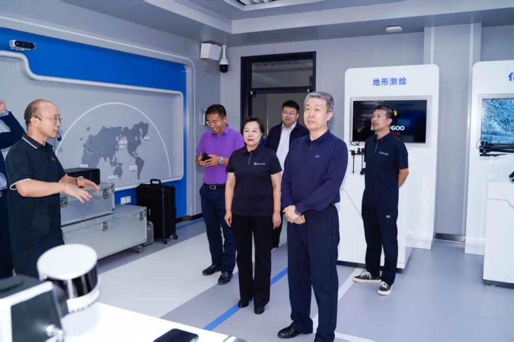
During the inspection phase, Wu Wenzhong and his delegation visited the core teaching practice area of Shenyang Institute of Technology Southern Surveying and Mapping Beidou Spatiotemporal Information Industry College, and conducted on-site research on the specific measures taken by the college in integrating technology application and teaching practice. The inspection team focused on the three in one technology ecosystem of "metaverse+Beidou and low altitude economy+satellite remote sensing", and conducted detailed research on the technical implementation effectiveness, teaching transformation path, and industry education integration mode in the field of intelligent surveying and mapping. They also inspected the operation of core teaching and practical modules such as intelligent monitoring terminals and inspection machines on site. During this period, Wu Wenzhong and his delegation also gained a detailed understanding of how the college integrates Academician Li Deren's cutting-edge concept of "Intelligent Processing and Application of Surveying, Mapping and Remote Sensing Data" into its daily curriculum system, as well as the exploration and practice of accurately aligning talent training goals with actual enterprise needs.
During the exchange and discussion, Wu Wenzhong emphasized that with the acceleration of technological innovation, the surveying and mapping industry is comprehensively moving towards the stage of intelligent transformation, based on the current development trend of the surveying and mapping industry. Academician Li Deren's concept of "integrated intelligent surveying and mapping system of air, space, and earth" provides clear direction guidance for the industry's development. Among them, real-life 3D, as the core carrier of intelligent surveying, has dual important values: on the one hand, it needs to be deeply integrated into daily teaching activities, so that students can solidly master practical skills such as data collection and modeling; On the other hand, we should actively integrate with smart cities, smart water conservancy and other fields in the industrial sector to promote the industrial application of technological achievements. Shen Gong Southern Surveying and Mapping Beidou Spatiotemporal Information Industry College needs to use key technologies such as real-life 3D as a link to continuously deepen the mechanism of industry education integration, ensure that teaching content keeps up with the pace of industry technology iteration, and provide high-quality applied talents with practical abilities for surveying and mapping enterprises. Ultimately, it will achieve deep integration of the education chain, talent chain, and industry chain, and build a development pattern of benign interaction between education and industry.
Meanwhile, Wu Wenzhong highly praised the construction effectiveness of the Industrial College. He stated that the college has efficiently integrated higher education resources with industrial resources in the field of surveying and mapping intelligence, successfully transforming the cutting-edge concepts of experts such as Academician Li Deren into concrete educational practices, providing a new model for cultivating applied talents in the industry, and playing an important role in promoting technological innovation and industrial upgrading in the national surveying and mapping geographic information field.
This inspection and exchange not only provided professional guidance for the subsequent development of Shenyang Institute of Technology Southern Surveying and Mapping Beidou Spatiotemporal Information Industry College, but also built a bridge for our school to further deepen cooperation with the Chinese Society of Surveying and Mapping and Southern Surveying and Mapping Technology Co., Ltd. It will effectively promote the college to achieve higher quality development in intelligent surveying and mapping talent training, technological achievement transformation, and other aspects.
Translated by Basic Courses Department